In today's blog article, we will present some insights into the remote-sensing observations that were (and partly are still being) performed at the Tāwhaki site, several hundred kilometers north of the goSouth-2 main site at Invercargill. Both of these sites are connected by the ACADIA project, a German Science Foundation funded initiative. See below for more details!
Clouds over the Southern Ocean play an important role in the climate system, yet they remain difficult to understand. Although these clouds strongly influence the Earth’s radiation balance, their accurate representation in weather and climate models is still difficult. Within the ACADIA (Aerosol-Cloud-rADiation-interaction over Aotearoa) project, we conduct a comprehensive ground-based observation campaign in New Zealand Aotearoa to improve our understanding of Southern Ocean clouds and aerosol–cloud interactions. The project constitutes a long-term international collaboration between Leipzig University (PI Heike Kalesse-Los), TROPOS (PI Patric Seifert) , and University of Canterbury (PI Adrian McDonald).
Observations within the frame of ACADIA are performed at two sites. Besides goSouth-2 observations with the TROPOS-LACROS suite at the MetService site in Invercargill, we use the Tāwhaki National Aerospace Centre as a key observational site (https://tawhaki.co.nz/tawhaki-national-aerospace-centre/). Tāwhaki is located on the east coast of New Zealand’s South Island near Christchurch (Fig. 1). At this site, we operate several remote-sensing instruments to continuously monitor clouds and precipitation, and atmospheric conditions.
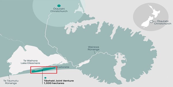
Figure 1 Location of the Tāwhaki National Aerospace Centre relative to Christchurch, New Zealand. Map adapted from the Tāwhaki National Aerospace Centre website.
Fig. 2 shows an overview of the deployed instrumentation at Tāwhaki. W-band Doppler cloud radar observations by Leipzig University were conducted from September 2025 to January 2026. University of Canterbury installed a CL61 depolarization ceilometer, a micro rain radar, a wind lidar and a disdrometer. Operations of these instruments are ongoing and in future the deployment of new additional instruments is foreseen, e.g., to collect filter samples of surface-near aerosols, or to perform tethered-balloon measurements. With this complementary instrumentation suite, we will investigate cloud microphysics, hydrometeor types, and precipitation formation in Southern Ocean air masses. Specific focus will be put on investigating the effect of clean-marine air masses from the Southern Ocean vs. aerosol-rich air masses from Australia containing dust and potentially wildfire smoke on cloud and precipitation formation processes.
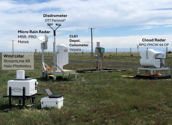
Figure 2 Ground-based remote-sensing instruments at the Tāwhaki National Aerospace Centre in New Zealand monitoring clouds, precipitation, and atmospheric conditions as part of the ACADIA field campaign (Photo by H. Kalesse-Los).
The observations at Tāwhaki are closely coordinated with measurements at the Invercargill site and with other field campaigns such as the HALO-South aircraft campaign (Sep–Oct 2025). Specifically, ground-based support by ACADIA for the aircraft campaign was complemented by 40 radiosonde launches providing a comprehensive view of the atmosphere over the Southern Ocean (Fig. 3).
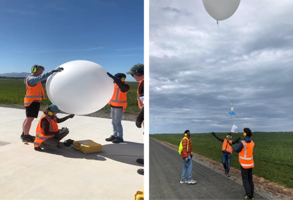
Figure 3 Radiosonde balloon preparation and launch at the Tāwhaki (Photo collage by H. Kalesse-Los).
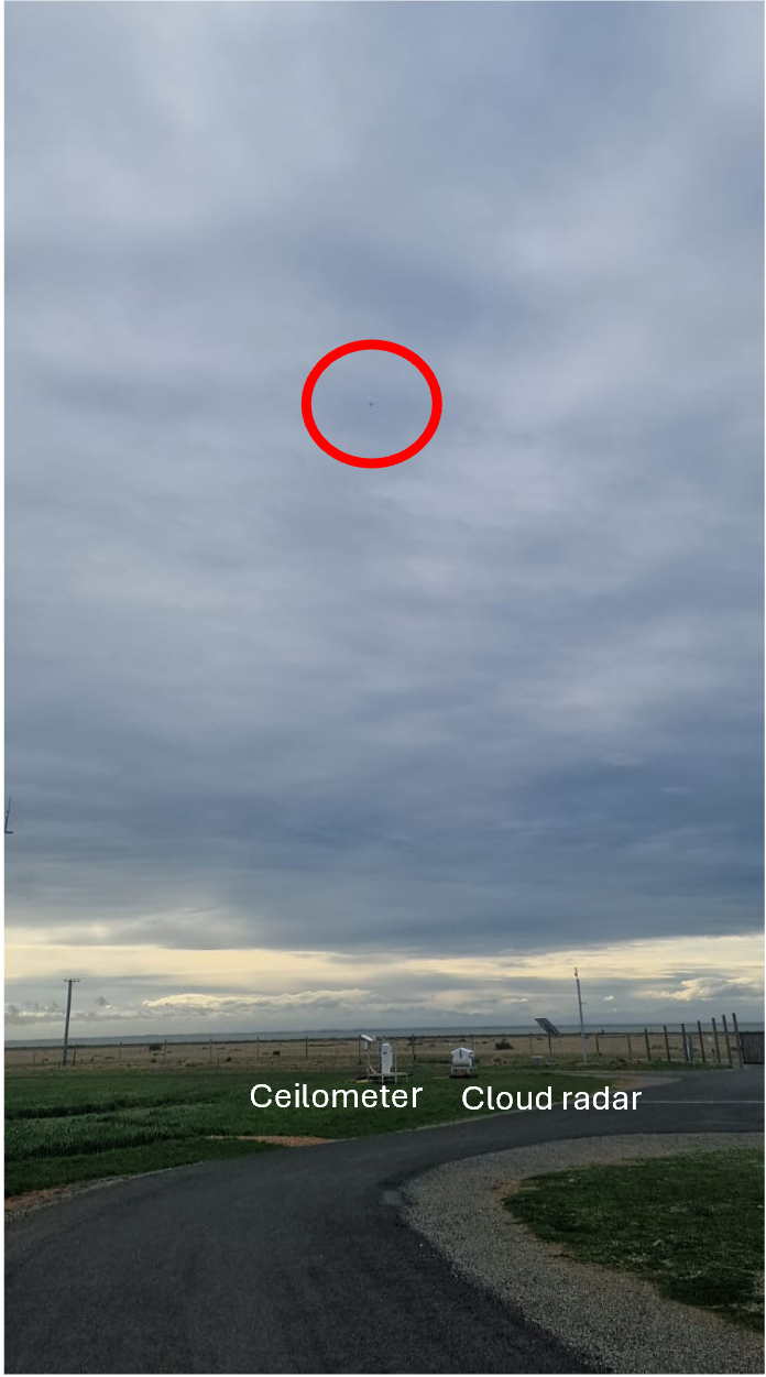
Figure 4 Overpass of the HALO research aircraft during the HALO-South campaign above the Tāwhaki site.
The observations collected at Tāwhaki will continue to support exciting research further. The analyses now underway will help us better understand the processes shaping clouds and precipitation over the Southern Ocean.
Authors: Heike Kalesse-Los, Gautami Niwane